
Oxford Thames River Trail - 3.1km
The Oxford Thames River Trail is accessed either by the main parking area on the 45th line (an extension of Queen St. E.) or from the Zorra Line Laneway (heading East) just immediatly south of the CN Rail level crossing in Beachville.
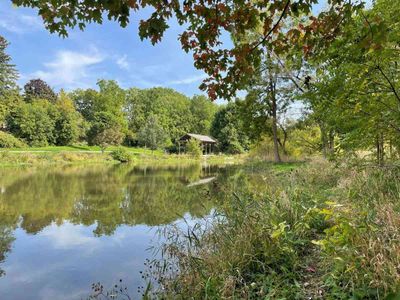
The recent trail extension includes a river loop and concrete boardwalk sections that offer beautiful views of the Thames River as it meanders westward from Woodstock towards Ingersoll.
The grassland and native tree plantings enhance the natural setting with birds and animals in abundance. The eastern end of the trail features an observation and picnic shelter on a bluff overlooking the Thames River and wetland/pond restoration projects.
Length: 4km + loops
Difficulty: Flat or gently sloping terain
Surface: Crushed stone with grassy sections and concrete boardwalks
Facilities: Sheltered picnic and observation deck at east end
Trail Uses: Walking, Cycling, Cross Country Skiing, Fishing (with MNR permit)
Location: 45th Line at 454779 or gated laneway just south of CNR crossing on Zorra Line in Beachville
Cautions: Beachville has two railway level crossings. Please observe all warning signals and be alert for train traffic. Please stay off railway property.
Contact Information
Map
Trip Ideas


